Geography.
 Santa Cruz de Tenerife is a Canary town which belongs to the province with the same name and became the capital of the island and of the Autonomous Community of the Canary Isles, shared with Las Palmas of Grand Canary.
This city is located between the bay of Santa Cruz de Tenerife and the Anaga Massif, rising as an amphitheater from the coast to the top.
It is 150.56 square kilometers in area and the population numbers nearly a quarter million.
It is noteworthy that its altitude, right at historic downtown Santa Cruz de Tenerife, is scarcely four meters above sea level while the town has 58.33 kilometers of coast.
The people of Santa Cruz are called “Santacruceros” and also “chicharreros” (which is commonly used for all inhabitants of Tenerife).
The province stands on a volcanic island, whose origin could go back to the tertiary period. It has a peculiar triangular shape and an area of 2 057 square kilometers, with a complex and steep orography.
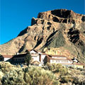
The best example of this is the fact that right in the middle of such a small area is the giant Teide Peak, which is 3 718 meters high, the highest point in all of the Spanish State territory.